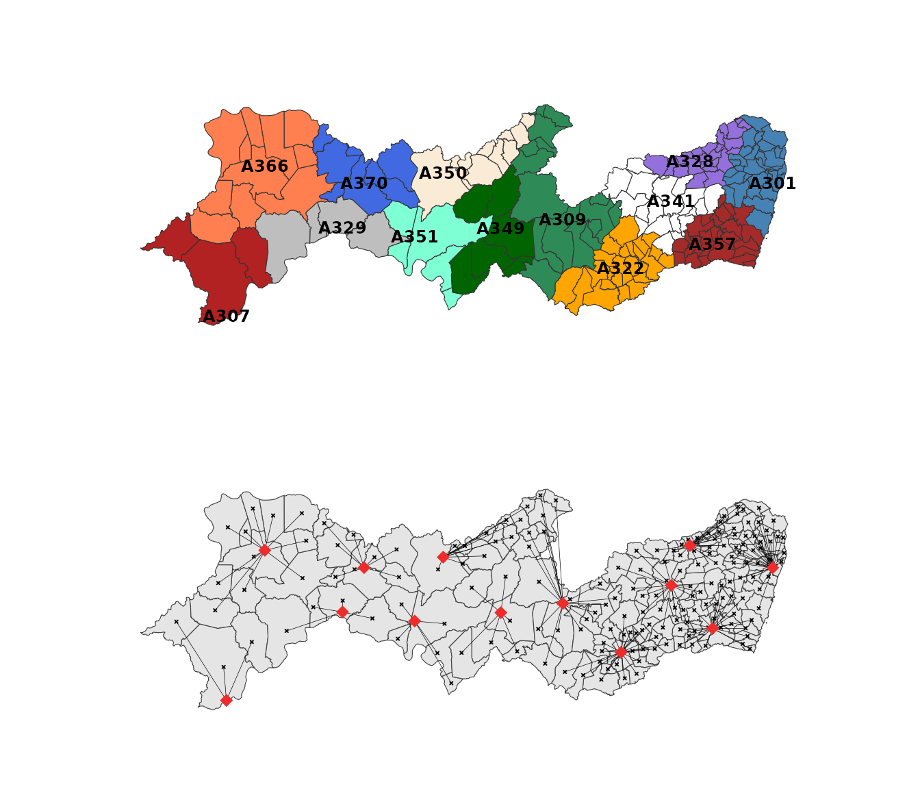
Finding the Closest INMET Station for Each Municipality
Source:vignettes/nearest_station.Rmd
nearest_station.RmdIntroduction
Many climate analyses need to assign each municipality to its closest
weather station. nearest_stations() automates this by
finding the nearest INMET station(s) for every municipality.
Preparing the data
The package includes datasets of Brazilian municipalities
(municipality) and INMET weather stations
(inmet_stations). This example uses the state of Pernambuco
(PE).
Finding the nearest station
Use nearest_stations() with n = 1 to find
the closest station for each municipality.
mun_stations_pe <- nearest_stations(
  municipality = municipality_pe,
  inmet_stations = inmet_stations_pe,
  n = 1
)

head(mun_stations_pe)
#> # A tibble: 6 × 5
#>   state_muni code_ibge7 code_wmo distance station_order
#>   <chr>           <dbl> <chr>       <dbl>         <int>
#> 1 PE            2600054 A301        25.7              1
#> 2 PE            2600104 A350        79.5              1
#> 3 PE            2600203 A307       104.               1
#> 4 PE            2600302 A341        25.2              1
#> 5 PE            2600401 A357         9.32             1
#> 6 PE            2600500 A322        66.1              1